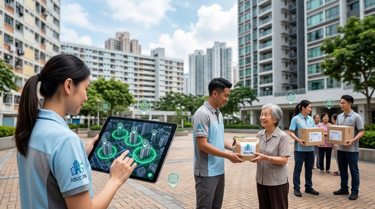
Picture this: a social worker in Sham Shui Po receives an alert the moment a elderly resident steps outside their subdivided flat. No phone call needed. No paperwork delay. Within minutes, a community care team is on its way with a hot meal and a welfare check. This is not a scene from a futuristic drama. This is the quiet power of geofencing in social services Hong Kong in 2026.
Geofencing uses GPS, Wi-Fi, Bluetooth, or cellular data to create virtual boundaries around real world locations. When someone enters or leaves that boundary, the system triggers an automatic action. For social services, this means aid can be delivered faster, more precisely, and with less manual coordination. Across Hong Kong, where dense housing, tight timelines, and limited outreach resources create constant pressure, geofencing is becoming a practical tool for teams that need to move from reactive to proactive care.
Geofencing is helping Hong Kong social services deliver aid faster by triggering actions when a person enters a defined area. This guide explains practical uses, from emergency food support to outreach for hidden elderly, plus privacy safeguards, common pitfalls, and steps to launch a pilot in 2026.
Geofencing in Social Services Hong Kong: How Location Tech Is Speeding Up Aid in 2026
Hong Kong’s social services sector has always raced against time. Caseworkers juggle dense urban routes, long waiting lists, and urgent client needs across a city that moves at lightning speed. In 2026, a growing number of agencies are turning to geofencing to close the gap between someone in crisis and the help they need. Geofencing in social services Hong Kong is no longer a futuristic experiment. It is a practical tool that helps teams reach vulnerable residents faster, allocate resources more fairly, and measure real world impact.
Geofencing uses GPS, Wi-Fi, or cellular data to create a virtual boundary. When someone enters or leaves that boundary, the system triggers an action. In social services, that action might be an alert to a caseworker, a notification to a service user, or an automatic update in a care record. It sounds technical, but the applications are deeply human.
Why Hong Kong Is Ready for Geofenced Aid Delivery
Hong Kong is one of the most densely populated cities in the world. With over 7.5 million people living in just over 1,100 square kilometres, the need for efficient aid delivery is urgent. Traditional methods often rely on phone calls, paper records, and manual coordination. That approach struggles when every minute matters.
Geofencing in social services Hong Kong changes this. A geofence is a virtual boundary. When a person with a smartphone enters or leaves that boundary, the system triggers an action. That action can be an alert, a notification, or a record. For social services, this means knowing when someone arrives at a food bank, when a home care worker enters a client’s estate, or when a mobile clinic crosses into a specific district.
The technology is not new. But its application across Hong Kong’s social service sector is accelerating. Agencies are pairing geofencing with case management software, mobile apps, and real time data to reach vulnerable residents faster, especially in dense urban areas like Sham Shui Po, Kwun Tong, and Yuen Long.
Why geofencing matters for Hong Kong social services
Hong Kong has one of the most compact urban landscapes in the world. Public housing estates, subdivided flats, and high rise towers sit close together. Delivery routes are short but complex. A social worker can visit several neighbourhoods in a single morning, yet traffic, weather, and building access can slow things down.
Geofencing changes how agencies plan and respond. Instead of relying on static addresses and manual check ins, staff set virtual boundaries around service points. When a client enters a zone, the system triggers an alert or an action. For example, a mobile care team can receive a notification the moment a home visit client crosses into a community centre courtyard. This reduces waiting time and makes outreach more responsive.
For Hong Kong, where density and speed matter, geofencing is a natural fit. It helps agencies deliver meals, medicine, and crisis support faster. It also supports better data collection for funders who want proof of impact. If you are exploring location based tools, this guide walks through real use cases, practical steps, and common mistakes to avoid.
Why geofencing matters for Hong Kong social services
Hong Kong is one of the most densely populated cities in the world. Housing estates pack thousands of residents into small blocks. Narrow footbridges, MTR stations, and wet markets create complex movement patterns. Social workers often struggle to track where clients are, especially when those clients are unhoused, living in subdivided flats, or moving between temporary shelters.
Geofencing changes that. A geofence is a virtual boundary around a real world location. When someone with a phone crosses that boundary, the system triggers an automatic response. For social services, that could mean sending an SMS reminder to a caregiver, alerting a case worker when a client enters a food bank zone, or notifying outreach teams when someone spends time near a known shelter.
In Hong Kong, where density is extreme and space is limited, geofencing in social services Hong Kong is becoming a quiet but powerful tool. It helps teams respond faster, use resources better, and reach vulnerable people before a small issue becomes a crisis.
Why Geofencing Matters for Hong Kong Social Services
Hong Kong has one of the highest population densities in the world. Over seven million people live in roughly 1,100 square kilometres. That means movement patterns are tight, and needs can change by the hour. Traditional outreach methods, like phone calls and paper forms, often lag behind real time reality.
Geofencing changes that. It creates a virtual boundary around a physical location. When a person with a mobile device enters or leaves that zone, the system triggers an action. For social services, this action might be an alert, a case note, a service reminder, or a targeted message about nearby support.
In 2026, geofencing in social services Hong Kong is moving from experimental to essential. Agencies use it to locate unhoused individuals who need mobile health care, remind elderly residents about meal deliveries, and alert field social workers when they enter a high need district like Sham Shui Po or Yau Ma Tei. The result is faster aid, better use of staff time, and more dignified support for people who often fall through the cracks.
What Is Geofencing and Why It Matters for Hong Kong
A geofence is a virtual boundary drawn around a real world location. When a smartphone or wearable device enters or exits that boundary, the system triggers an action. That action might be a notification, a data log, or an automated message to a social worker.
In Hong Kong, where density is extreme and housing estates pack thousands of residents into a single block, geofencing offers a level of precision that older outreach methods cannot match. Instead of relying on a client to call when they need help, agencies can detect when someone arrives at a service point, a food bank, or a community centre. That means faster responses, better data, and less guesswork.
This is not about tracking people. It is about building a safety net that responds the moment someone steps into reach.
What Is Geofencing in Social Services?
Geofencing uses GPS, Wi-Fi, Bluetooth, or cellular data to create a virtual boundary around a real world location. When a person with a mobile phone enters or exits that boundary, the system triggers an automated action. In social services, that action could be a notification, a check in, or an alert to a case worker.
For Hong Kong, with its dense population and narrow streets, geofencing fits naturally. It works in public housing estates, community centres, food banks, and outreach vans. It can also support emergency response during typhoons or heatwaves.
The key idea is simple: location becomes context. When the system knows someone is near a service point, it can respond instantly. That response could be a reminder, a queue ticket, or a direct message to a social worker. This is how geofencing in social services Hong Kong agencies are adopting today.
Why geofencing matters for Hong Kong social services
Hong Kong has one of the densest urban environments in the world. Many families live in subdivided flats. Many elderly residents live alone in old Kowloon tenements. Outreach teams often struggle to locate clients who cannot describe their surroundings well.
Geofencing solves this by creating a virtual boundary around a real-world location. When a person with a mobile device enters that boundary, the system triggers an action. For social services, this action could be a notification, a case file update, or an alert to a field worker. The result is faster, more precise aid delivery.
The technology is not new. Logistics companies have used it for years. What is new is how Hong Kong social services are adapting it for local realities: dense public housing estates, typhoon season, and the need for real time support during emergencies.
What Is Geofencing in Social Services?
Geofencing uses GPS, Wi-Fi, Bluetooth, or cellular data to create a virtual boundary around a physical location. When a person enters or leaves that boundary, the system triggers an action. In social services, this means a caseworker can know when a client arrives at a food bank, when a mobile clinic enters a village, or when an elderly resident steps outside a safe zone.
For Hong Kong, this is especially powerful. The city has high smartphone penetration, dense public housing estates, and a population used to using apps for daily tasks. Geofencing turns location data into timely care.
Why geofencing matters for Hong Kong social services
Hong Kong is compact but complex. Many vulnerable groups live in subdivided flats, temporary housing, or remote villages in the New Territories. Outreach teams often struggle to locate families that change address often. Geofencing changes that.
When a client walks into a designated area, the system can trigger a notification. That could alert a social worker, send a reminder to the client, or log a visit automatically. This reduces no shows, saves travel time, and lets caseworkers focus on face to face care instead of paperwork.
For funders and administrators, geofencing provides something just as valuable: evidence. Real time location data shows where services are needed most, when they are used, and how far people travel. That evidence supports funding applications, resource planning, and public accountability.
What Is Geofencing in Social Services?
Geofencing is a location based technology that creates a virtual boundary around a real world location. When a person with a smartphone enters or leaves that boundary, the system triggers an action. In social services, that action might be a notification, a form prefill, a check in, or an automatic case note.
For Hong Kong, where density is extreme and buildings are tightly packed, geofencing can work with remarkable precision. It is not about tracking people without consent. It is about using location data ethically to reach those who need help faster, especially in a city where time and distance can decide outcomes.
Why Geofencing Matters for Hong Kong Social Services
Hong Kong has one of the most compact urban geographies in the world. Over 7 million people live in about 1,100 square kilometres, with many districts marked by high rise towers and narrow streets. That density creates both pressure and possibility. When an outreach team knows exactly who is nearby and what they need, a 15 minute walk can become a 3 minute delivery.
Geofencing uses GPS, Wi-Fi, Bluetooth beacons, or cellular data to create a virtual boundary. When someone enters or leaves that boundary, the system triggers an action. For social services, this can mean sending an alert when a family enters a flood prone area, or notifying a caseworker when a client is near a food bank. In Hong Kong, where space is tight and needs shift fast, this kind of location awareness changes how aid reaches people.
The 2026 picture is clear. Agencies that once relied on phone calls and paper files are now using geofencing to shorten response times, target outreach, and protect privacy at the same time. The result is a more responsive social service sector that meets people where they are, literally.
Why geofencing matters for Hong Kong social services
Hong Kong is one of the most densely populated cities on earth. High rises, tight streets, and fast moving crowds create both urgency and opportunity. When a typhoon signal goes up, or when an outbreak forces a district into lockdown, social workers need to know who is where, and what they need, within minutes.
Geofencing uses GPS, Wi-Fi, Bluetooth beacons, and mobile networks to create virtual boundaries. When someone crosses one of these boundaries, the system triggers a response. For social services, that could mean an alert, a notification, or an automatic record update. In a compact city like Hong Kong, geofencing in social services Hong Kong is becoming a practical way to deliver aid faster, especially in dense districts like Sham Shui Po, Yau Ma Tei, and Kwun Tong.
This article walks through how social services in Hong Kong are using geofencing in 2026, with real use cases, practical steps, and common mistakes to avoid.
Geofencing in social services Hong Kong is moving from experimental to essential. Agencies now use location triggers to speed up emergency food delivery, coordinate outreach teams, and protect client privacy. This guide explains how your organisation can adopt geofencing, avoid common mistakes, and measure real impact in 2026.
Hong Kong moves fast. Its social services need to move faster. When a typhoon warning lifts, when a public housing estate goes into lockdown, or when a sudden surge of need appears in Sham Shui Po or Yuen Long, the difference between help arriving in minutes versus hours can change everything.
That is why geofencing is becoming one of the most practical tools in the city’s social sector. Location based technology, once used mainly for retail ads or delivery apps, is now helping social workers, NGOs, and government contractors reach vulnerable people faster. This article looks at how geofencing in social services Hong Kong is quietly changing the way aid is delivered in 2026.
What Is Geofencing and Why It Matters for Hong Kong
Geofencing uses GPS, Wi-Fi, Bluetooth beacons, or cellular data to create a virtual boundary around a physical location. When a device enters or leaves that boundary, the system can trigger a message, alert, or action. For social services, this means you can know when a home care worker arrives, when a meal delivery van crosses into Sham Shui Po, or when a youth centre visitor checks in for counselling.
Hong Kong is a dense city with narrow streets, tall mixed use towers, and rapid transit connections. That density makes geofencing particularly useful. A radius of a few metres can cover a specific housing block, a community centre, or a temporary shelter. The result is aid that arrives faster, with less guesswork and more accountability.
The idea is not to track people like parcels. It is to build a responsive safety net. When someone enters a district where a mobile clinic is parked, or where a food bank is handing out supplies, the system can alert staff instantly. That is the promise of geofencing in social services Hong Kong is already starting to explore.
What Is Geofencing and Why Does It Matter for Aid Delivery?
Geofencing uses GPS, Wi-Fi, Bluetooth, or cellular data to create a virtual boundary around a physical location. When a person with a mobile device enters or exits that boundary, the system can trigger a notification, send an alert, or log a record. For social services, this means knowing when someone is near a service point, a safe zone, or a field worker, without requiring manual check ins.
In Hong Kong, where density is extreme and space is tight, geofencing helps organisations respond faster. A case worker can receive an alert the moment a client arrives at a community centre. A mobile food truck can notify nearby residents when meals are ready. A youth outreach team can know when a young person enters a designated safe zone. These are not futuristic ideas. They are running in pilot projects across the city right now.
This article explores how geofencing in social services Hong Kong is becoming a core part of aid delivery. You will learn practical steps, common mistakes, and what the data shows.
Why Geofencing Matters for Social Services in Hong Kong
Hong Kong is one of the most densely populated places on earth. Space is tight, foot traffic is high, and needs can change by the hour. For social services, reaching people fast is often the difference between a small issue and a crisis. Geofencing creates a virtual boundary around a physical location. When a person with a connected device enters or leaves that boundary, the system triggers an action. That action might be a notification, a record, or an alert to a case worker.
This matters because many Hong Kong families live in subdivided flats, temporary housing, or rely on community centres spread across dense urban areas. A geofence around a food bank, a mobile clinic stop, or an outreach team’s route can automatically log visits, send reminders, and connect people to services the moment they arrive. For social workers, this means less time on paperwork and more time on face to face support.
The technology is not futuristic. It is already running in housing estates, district health centres, and charity warehouses across the city. In 2026, geofencing is becoming a standard tool for aid delivery, especially for organisations serving the elderly, low income families, and unhoused neighbours.
This article explores how Hong Kong social services are using geofencing to deliver aid faster, and how your organisation can adopt the same approach.
Why geofencing matters for Hong Kong social services
Hong Kong is one of the most densely populated cities in the world. Space is tight, foot traffic is heavy, and needs often shift within a single district. Traditional outreach methods, like phone calls and paper forms, struggle to keep pace with the speed of daily life in places like Sham Shui Po, Yau Ma Tei, or Kwun Tong.
Geofencing changes that. It creates a virtual boundary around a physical location. When someone with a mobile device crosses that boundary, it triggers an automated response. For social services, this means reaching people where they are, with the right message, at the right moment.
Imagine a mobile food bank van entering a public housing estate. A geofence triggers a notification to nearby residents who have opted in: “Free warm meals available now at Lei Cheng Uk.” That is not a futuristic idea. It is already happening in Hong Kong in different forms.
For a densely packed city like Hong Kong, where space is tight and people move fast, geofencing helps social services meet people where they are. It cuts out phone tag, missed home visits, and outdated resource lists. It also opens the door to more proactive care, rather than waiting for people to find help.
Geofencing is transforming how Hong Kong social services deliver aid in 2026. By setting virtual boundaries around shelters, food banks, clinics, and outreach zones, agencies can trigger automatic alerts, send targeted messages, and coordinate teams in real time. This guide explains the practical steps, real benefits, and common pitfalls to help your organisation respond faster.
Why Geofencing Matters for Hong Kong Social Services
Hong Kong moves at a relentless pace. The city packs over seven million people into just over 1,100 square kilometres, and many social service clients live in dense districts like Sham Shui Po, Yau Tsim Mong, and Kwun Tong. In this environment, time is not just money. It can decide whether a family receives a hot meal, whether a senior gets a welfare check, or whether a homeless person finds shelter before a typhoon hits.
Geofencing changes how aid reaches people. Instead of waiting for someone to fill out forms or call a hotline, social workers can now trigger help the moment a person crosses into a service zone. That shift might sound small, but for a single parent in a subdivided flat in To Kwa Wan, or an elderly resident in Sham Shui Po, it can mean the difference between waiting days and receiving support within hours.
In 2026, geofencing in social services Hong Kong is no longer a pilot concept. It is becoming a standard tool for organisations that want to meet people where they are, literally and digitally. This article walks through what geofencing means for social work, how agencies across Hong Kong are using it, and how your organisation can adopt it responsibly.
Geofencing is transforming how Hong Kong social services deliver aid in 2026. By setting digital boundaries around shelters, food banks, or disaster zones, agencies can send targeted alerts, coordinate outreach, and track resources in real time. This guide covers practical use cases, step by step implementation, common pitfalls, and expert tips to help your organisation respond faster and serve clients better.
Why geofencing matters for Hong Kong social services
Hong Kong moves fast. Dense housing estates, crowded MTR stations, and tight delivery windows mean timing is everything in social work. A family in Sham Shui Po might need emergency food support within hours, not days. A homeless outreach team in Yau Ma Tei may need to know when someone they support has arrived at a drop in centre. A meal delivery service in Kowloon City might need real time route updates for volunteers.
Geofencing helps with all of this. It creates virtual boundaries around real world locations. When someone enters or leaves that boundary, the system triggers an automatic action. For social services in Hong Kong, this means faster aid, better resource allocation, and more proactive outreach.
This article explores how geofencing in social services Hong Kong is changing the way charities, NGOs, and government agencies operate. You will learn practical steps, real examples, and common pitfalls to avoid.
Geofencing helps Hong Kong social services deliver aid faster by triggering location based alerts, automating case updates, and guiding field teams to those in need. This guide covers real use cases, setup steps, common mistakes, and practical tips for 2026.
Why Geofencing Matters for Hong Kong’s Social Services
Hong Kong moves fast. Dense neighbourhoods, tight timelines, and constant weather disruptions mean social workers often race against the clock. Traditional outreach methods rely on phone calls, paper records, and manual follow ups. That approach creates delays. Geofencing changes the game by using location data to trigger actions the moment someone enters or leaves a defined area.
For social services, this means faster aid delivery, better safety checks for home visits, and smarter use of outreach teams. In 2026, geofencing is no longer a futuristic idea. It is a practical tool that helps non-profits, district officers, and NGOs respond to needs in real time.
If you are new to the broader digital shift in this sector, you may want to read about why Hong Kong’s social service agencies need a digital transformation strategy. It gives useful context for how location based tools fit into the larger picture.
What Is Geofencing in a Social Services Context?
Geofencing uses GPS, Wi-Fi, Bluetooth, or cellular data to create a virtual boundary around a physical location. When a person with a mobile device enters that boundary, the system can trigger an automatic action. For social services in Hong Kong, this means reaching people where they are, often in dense urban environments.
Think of a community centre in Sham Shui Po. A geofence around the centre can detect when a registered service user arrives. That triggers a check in, sends a reminder to a case worker, or even opens a queue ticket. No forms. No phone calls. Just a location signal doing the work.
In 2026, geofencing is no longer a novelty. It has become a practical tool for agencies that want to deliver aid faster and use their limited resources more wisely.
Why geofencing matters for social services in Hong Kong
Hong Kong is one of the most densely populated cities in the world. Space is tight. Travel times can be unpredictable. For social workers, every minute spent on logistics is a minute taken away from care. Geofencing helps solve this by automating location based tasks.
A geofence is a virtual boundary around a real world location. When a person with a smartphone enters or leaves that boundary, the system triggers an action. In social services, this means instant alerts, automated check ins, and location verified case notes. It is not about tracking people for surveillance. It is about knowing when someone is near a service point so you can respond faster and more accurately.
In Hong Kong, where housing estates are dense and many families rely on multiple social services, geofencing is becoming a quiet workhorse. It helps teams coordinate meal deliveries, home visits, outreach vans, and emergency responses. The result is faster aid, less paperwork, and better use of scarce resources.
What Is Geofencing and Why Does It Matter for Hong Kong?
A geofence is a virtual boundary. You define a real world area using GPS, Wi-Fi, or cellular data. When a device enters or leaves that area, the system triggers an action. For social services, this could mean alerting a case worker when a client arrives at a food bank, or notifying a team when a field officer is near a high risk household.
Hong Kong is one of the most densely populated cities on earth. Public housing estates in places like Tin Shui Wai, Sham Shui Po, and Tseung Kwan O serve large numbers of residents in compact blocks. Narrow footbridges, crowded MTR exits, and dense mixed use buildings make physical outreach slow. Geofencing cuts through that friction. It turns location into a trigger for action.
The result is faster aid, better resource allocation, and more responsive outreach for charities, NGOs, and government backed social service teams. This is why geofencing in social services Hong Kong has become such a hot topic for 2026.
What Is Geofencing and Why It Matters for Hong Kong
Geofencing uses GPS, Wi-Fi, Bluetooth beacons, or cellular data to create a virtual boundary around a physical location. When someone with a mobile device enters or leaves that boundary, the system triggers a pre-set action. That action can be a notification, a data log, a form prompt, or an alert to a caseworker.
For social services in Hong Kong, this matters a lot. The city is dense, vertical, and fast moving. Many families in need live in subdivided flats, temporary housing, or remote New Territories villages. Traditional outreach often misses them. Geofencing flips that by letting services meet people where they are, without requiring extra paperwork or a visit to an office.
In 2026, geofencing in social services Hong Kong is moving from experimental to practical. Agencies now use it to shorten response times, locate vulnerable residents, and coordinate teams on the ground. It is not about tracking people without consent. It is about creating a more responsive safety net.
What is geofencing in social services?
Geofencing uses GPS, Wi-Fi, Bluetooth beacons, or cellular data to set up a virtual boundary. When a device enters or leaves that boundary, the system triggers an action. For social services, this means sending a reminder, alerting a caseworker, or logging a visit the moment someone arrives at a service point.
In Hong Kong, the density of public housing estates and the compact layout of districts like Sham Shui Po and Yau Tsim Mong make geofencing especially practical. You can define a zone around a community centre, a food bank, or a temporary shelter. When someone with the right permissions crosses that zone, the system knows.
That knowledge opens up new ways to deliver aid faster, track outreach, and protect privacy. The key is to use geofencing as a tool for coordination, not surveillance.
Why geofencing matters for social services in Hong Kong
Hong Kong has one of the most concentrated urban populations in the world. Many families live in subdivided flats. Older adults often live alone in dense public housing estates. Nonprofit teams are stretched thin, and caseworkers juggle huge caseloads. In this environment, time is not just money. Time is safety.
Geofencing helps social services respond faster because it automates the first step of many workflows: knowing where someone is. Instead of asking a client to fill out another form or make a phone call to confirm their location, a geofence can detect when they arrive at a service point, a food bank, or a community centre. That simple trigger can save hours of manual coordination.
For example, a social worker in Sham Shui Po can receive an instant notification when a family that requested food aid enters a designated distribution zone. No phone tag. No missed appointments. Just a quiet alert that says, in effect, the right person is here, at the right place, at the right time.
Geofencing is transforming Hong Kong social services by automating aid alerts, optimising outreach routes, and improving caseworker safety. This guide explains how location based technology works in practice, gives practical implementation steps, and highlights common pitfalls to avoid, helping your agency deliver faster, more dignified support in 2026.
Why geofencing matters for social services in Hong Kong
Hong Kong moves fast. Dense towers, crowded MTR stations, and tight schedules mean that outreach workers often struggle to reach vulnerable residents in time. Geofencing flips that problem on its head. Instead of waiting for someone to ask for help, your service can send support the moment a person enters a defined area.
Think of a geofence as an invisible boundary drawn around a location. When someone with a mobile device crosses that boundary, it triggers an action. For social services, that action could be an alert, a reminder, or a resource offer. In 2026, this is not science fiction. It is already reshaping how aid reaches people in Hong Kong.
What is geofencing in social services Hong Kong?
Geofencing in social services Hong Kong means using GPS, Wi-Fi, Bluetooth beacons, or cellular data to create virtual perimeters around real world locations. When a service user crosses into that perimeter, the system sends a notification, updates a case file, or triggers a workflow.
For example, a community centre in Sham Shui Po can set a geofence around its building. When a senior who receives meal delivery enters the zone, staff get an alert. They can prepare the meal package before the person reaches the counter. That is geofencing in action.
This is not about tracking people without consent. It is about using location data ethically and transparently to reduce waiting times, improve outreach, and ensure no one falls through the cracks. In 2026, more Hong Kong social services are adopting this approach.
Why geofencing matters for Hong Kong social services
Hong Kong is dense. The city has narrow streets, packed residential blocks, and a population used to moving fast. Social workers often spend hours travelling between districts like Sham Shui Po, Yau Tsim Mong, and Kwun Tong. Geofencing helps by creating virtual boundaries around places like food banks, community centres, or even a client’s last known address.
When a person enters or leaves a defined area, the system can trigger an alert or an action. For example, a caseworker might get notified when a home visit is about to start. A food bank might know when a family has arrived to collect a parcel. This reduces waiting times, improves coordination, and makes aid delivery more humane.
The idea is not to track people for the sake of surveillance. It is about using location data to reach vulnerable residents faster, especially in a dense city like Hong Kong where time and space are both precious.
Why geofencing matters for Hong Kong social services
Hong Kong has a unique urban landscape. High density housing, narrow footpaths, and a fast paced lifestyle mean that outreach teams often struggle to connect with the people who need help most. Geofencing helps by creating a virtual boundary around a location. When someone with the right permissions enters that boundary, the system triggers an action. For social services, that action might be an alert, a case note update, or a notification to a field worker.
This matters in Hong Kong because many families live in subdivided flats, temporary housing, or remote villages in the New Territories. A home visit might require multiple attempts. A geofence around a public housing estate or a community centre can tell a social worker the moment a client arrives for an appointment, or when a field officer enters a high need area.
The result is faster, more accurate aid delivery. And in 2026, that speed can change lives.
Why Geofencing Makes Sense for Hong Kong’s Social Services
Hong Kong is compact but extremely dense. Delivery routes, outreach visits, and emergency responses all happen within a small geographic area. That density is exactly why geofencing works so well here. Instead of relying on manual updates or phone calls, social workers can know when someone enters a service zone, when a meal is ready for pickup, or when a home visit is about to start.
Think about the city’s geography. From Central to Tseung Kwan O, from Tuen Mun to Chai Wan, travel time can be unpredictable. Geofencing removes guesswork. It triggers an action the moment a person crosses a virtual boundary. This is not about surveillance. It is about response speed.
For example, a mobile food bank in Sham Shui Po can send an automatic alert when a delivery van enters a defined radius. Staff know to prepare hampers. Clients know the van is close. No phone tag. No missed windows. This kind of location aware service delivery is already being piloted by forward thinking NGOs and social enterprises across Hong Kong.
Why Geofencing Matters for Hong Kong Social Services
Hong Kong is one of the most densely packed cities on earth. Housing estates in areas like Tin Shui Wai, Kwun Tong, and Sham Shui Po hold thousands of residents in just a few blocks. Traditional outreach often relies on scheduled visits or phone calls, which can miss people who are mobile, working irregular hours, or living in subdivided flats.
Geofencing changes that. A geofence is a virtual boundary around a physical location. When a person with a location enabled device crosses that boundary, it triggers an action. For social services, this can mean an instant notification, a tailored message, or a caseworker alert.
In 2026, Hong Kong agencies are using geofencing to meet people where they are. Not just physically, but contextually. It helps deliver aid faster, target resources more precisely, and reduce the time between identifying a need and meeting it.
This article explores how geofencing in social services Hong Kong is taking shape, with practical examples, honest limitations, and a step by step guide to implementation.
Geofencing is helping Hong Kong social services move from reactive aid to proactive, location aware support. Agencies can now send targeted assistance, alerts and resources the moment someone enters a service zone. This guide covers real use cases, practical setup steps, common mistakes, and the privacy safeguards every organisation must adopt in 2026.
Why geofencing matters for Hong Kong social services
Hong Kong is one of the most densely populated cities on earth. Space is tight, foot traffic is heavy, and social service teams often struggle to reach vulnerable people before a small issue becomes a crisis. Geofencing, a location based technology that triggers actions when a device enters a virtual boundary, is changing how aid is delivered across the city.
Think of it as a digital safety net. When someone crosses into a predefined zone, the system can send an alert, log a visit, or notify a social worker. For an organisation serving elderly residents in Sham Shui Po or youth outreach in Mong Kok, this means faster response, better data, and more personalised care.
The idea is not futuristic. It is already happening in Hong Kong social services today. And in 2026, it is becoming a core part of how agencies plan outreach, manage caseloads, and coordinate emergency support.
Geofencing in social services Hong Kong is moving from pilot to practice. Agencies use virtual boundaries to trigger aid alerts, coordinate outreach teams, and deliver support faster in dense districts like Sham Shui Po and Yau Tsim Mong. With careful privacy design, location data becomes a tool for dignity, not surveillance.
What geofencing means for social services in Hong Kong
Geofencing sounds technical, but the idea is simple. You draw a virtual boundary around a place. When someone with a mobile phone enters that space, the system can trigger an automatic action. For social services, that action might be a notification, a check in, or an alert to a case worker. In a compact, high density city like Hong Kong, this becomes extremely powerful because movement patterns are dense and predictable.
Consider the daily reality of outreach teams in Sham Shui Po, Yau Ma Tei, or Kwun Tong. Staff often spend hours locating service users, verifying visits, and updating records. Geofencing removes much of that guesswork. Instead of asking a client to call when they arrive, the system knows. Instead of sending a team to a hotspot on a hunch, you can send them based on live foot traffic data.
This article explores how Hong Kong social services are using geofencing to deliver aid faster in 2026, with practical examples, implementation steps, and common pitfalls to avoid.
Geofencing lets Hong Kong social services deliver aid in real time by triggering actions when someone enters a defined area. It improves outreach for elderly care, emergency food support, and mental health services. Success depends on privacy safeguards, consent, and thoughtful data design. This guide explains practical steps, common mistakes, and real use cases.
Why geofencing is becoming essential for Hong Kong social services
Hong Kong is one of the most densely populated cities in the world. Tower blocks rise above narrow streets. Public housing estates pack thousands of residents into a few city blocks. For social workers, this density creates both opportunity and challenge. When a typhoon warning is about to drop, or a cooling centre opens in a heatwave, reaching the right people at the right moment matters.
Traditional outreach often depends on phone calls, posters, or community visits. These methods work, but they are slow. Geofencing changes the equation. It lets you define a virtual boundary around a location, then send an alert or trigger an action when someone enters, leaves, or lingers inside that zone. For social services in Hong Kong, this means aid can arrive faster, with less guesswork, and with better use of limited staff time.
This article explores how geofencing in social services Hong Kong is becoming a practical tool for outreach, crisis response, and resource allocation. You will see real use cases, a clear process for launching a pilot, and honest guidance on privacy.
Why geofencing matters for Hong Kong social services
Hong Kong is one of the most densely populated cities in the world. It has a unique mix of high rises, subdivided flats, remote villages, and busy public housing estates. For social workers and NGOs, reaching people in need is not just about having services. It is about being in the right place at the right time.
Geofencing uses GPS, Wi-Fi, Bluetooth, or cellular data to create virtual boundaries. When a person with a location enabled device crosses one of these boundaries, it can trigger a notification, an automatic check in, or a data log. For social services, this opens a new way to deliver aid faster and more precisely.
In 2026, Hong Kong is seeing more pilot projects that use geofencing for outreach, emergency food assistance, and even mental health follow ups. The city’s density, high smartphone penetration, and compact geography make it an ideal testing ground. This article explores how geofencing is changing social services in Hong Kong, with practical examples and steps for adoption.
Why geofencing matters for social services in Hong Kong
Hong Kong has one of the world’s most concentrated urban populations. Over 7.5 million people live in a relatively small area. That density creates both challenges and opportunities for aid delivery. When a typhoon warning hits, when a fire breaks out in an old Kowloon tenement, or when a family suddenly loses their home, minutes matter. Geofencing helps social workers respond faster by sending location based alerts the moment a person enters a service zone.
The idea is simple. A geofence is a virtual boundary drawn around a real world location. When someone with a mobile device crosses that boundary, the system can trigger an action. For social services, that action might be a notification to a case worker, a reminder to a client, or an update to a central dashboard.
Hong Kong’s dense urban layout makes this especially powerful. High rises, tight blocks, and fast paced life mean that location data can be the difference between a missed appointment and a timely intervention. For social services, this is not about surveillance. It is about reaching people where they are, faster and with more dignity.
Why Geofencing Matters for Hong Kong Social Services
Hong Kong is one of the most densely populated cities on earth. Over seven million people live in an area smaller than many midsize cities. That creates unique challenges for social workers, outreach teams, and charity staff. Travel time alone can eat into a field worker’s day. Geofencing helps by creating a virtual boundary around a location. When someone enters or leaves that area, the system triggers an alert or action.
For social services, this means a caseworker can know when a home visit should start, when a meal has been picked up, or when a senior has left a designated safe zone. The result is faster aid, safer clients, and less guesswork.
The technology is not futuristic. It is already being used by forward looking nonprofits and public agencies across Hong Kong. The question is no longer whether geofencing works. It is how well your organisation can integrate it.
What is geofencing and why does it matter for Hong Kong?
Geofencing uses GPS, Wi-Fi, Bluetooth, or cellular data to create a virtual boundary around a real world location. When a device enters or leaves that boundary, the system triggers an action. For social services, that action could be an alert, a data log, or an automatic message to a caseworker.
Hong Kong’s dense urban environment makes geofencing especially useful. The city has high rise estates, tight streets, and a population that is almost always carrying a smartphone. For outreach teams, this means you can know when a field worker arrives at a Sham Shui Po subdivided flat, or when a meal delivery van enters a public housing estate in Tin Shui Wai. You can also trigger location based reminders for elderly residents who often forget appointments.
Geofencing is transforming Hong Kong social services by enabling faster, more targeted aid. Agencies can set virtual boundaries around shelters, food banks, or community centres to automate alerts, coordinate outreach, and track delivery in real time. Done right, it reduces response times, protects privacy, and improves resource use. This guide covers practical steps, real examples, and common pitfalls to avoid.
Why geofencing is becoming essential for Hong Kong social services
Hong Kong moves fast. Narrow streets, dense towers, and a population used to efficiency mean waiting is never popular. Social services now face the same pressure. When a typhoon signal is about to be hoisted, or a heat wave hits public housing estates, every minute matters. Geofencing helps teams respond faster by triggering actions the moment someone enters a virtual boundary.
Think of a mobile food bank van. Instead of asking recipients to check schedules manually, the service can send an alert the second a registered user is near a distribution point. That is not science fiction. It is already happening across the city in small pilot projects and larger NGO operations. Location based technology is no longer just for retail ads or ride hailing apps. In 2026, social services in Hong Kong are quietly using geofencing to reach vulnerable people before they fall through the cracks.
Geofencing is transforming Hong Kong social services by enabling real time aid delivery, smarter outreach, and better resource allocation. This guide explains how geofencing works in local welfare settings, shares practical implementation steps, and shows how your organisation can use location based tools to reach vulnerable people faster in 2026.
Why geofencing matters for Hong Kong social services
Hong Kong moves fast. Dense neighbourhoods, high rises, and a population used to instant services mean social workers often struggle to keep pace. Geofencing flips that dynamic. Instead of waiting for people to come forward, agencies can now send help the moment someone crosses a virtual boundary. This matters in a city where every minute counts, especially for meal deliveries, medical outreach, or emergency shelter support.
Geofencing in social services Hong Kong is not about surveillance. It is about precision. When a caseworker knows a family has arrived at a food bank, or a mobile clinic has entered a specific estate, the team can act immediately. No phone tag. No lost time. No guesswork.
The technology works through GPS, Wi-Fi, beacons, or cellular data. A virtual fence is set around a location. When a person with a opted-in device enters or leaves that zone, the system triggers an alert. For social services, this means knowing when someone arrives for an appointment, when a meal is collected, or when a field worker has reached a high risk building in Sham Shui Po.
This is not about surveillance. It is about coordination, dignity, and speed. When done well, geofencing lets non-profits respond the moment someone needs help, not hours later. For Hong Kong’s dense urban landscape, with its mix of public housing estates, subdivided flats, and community centres, geofencing offers a practical way to close the gap between need and support.
Geofencing is transforming Hong Kong social services by triggering location aware alerts, automating outreach, and shortening emergency response times. Agencies use virtual boundaries to identify where people are and deliver aid faster. This guide explains how geofencing in social services Hong Kong works, shares practical setup steps, and highlights common mistakes to avoid. Learn how to modernise your service delivery in 2026.
What Is Geofencing and Why It Matters for Hong Kong
Geofencing uses GPS, Wi-Fi, Bluetooth, or cellular data to create virtual boundaries around real world locations. When someone with a mobile device enters or leaves that boundary, the system can trigger an action. For social services in Hong Kong, this means sending a food voucher the moment a family arrives at a community centre, or alerting a caseworker when a senior leaves a care zone unexpectedly.
Hong Kong is a dense city with narrow streets, tight timelines and high foot traffic. That makes geofencing especially useful. You can deliver support faster, target resources where they are needed, and reduce the friction that comes with filling out forms or waiting in line.
Geofencing in social services Hong Kong is not about surveillance. It is about precision. It lets agencies know when someone is nearby, what they may need, and how to route help before a small issue becomes a crisis.
Geofencing in social services Hong Kong is turning aid into a location aware service. By sending timely alerts, coordinating outreach teams, and personalising support based on where people are, agencies can shorten response times, reduce wasted travel, and meet people where they are. This guide covers real use cases, setup steps, and common pitfalls to avoid.
Why Geofencing Is Entering Hong Kong’s Social Sector
Hong Kong moves fast. Narrow streets, dense public housing estates, and a population glued to mobile phones make the city a natural fit for location based services. Social service agencies are beginning to use geofencing in social services Hong Kong contexts to reach vulnerable residents faster, especially in areas like Sham Shui Po, Kwun Tong, and Tuen Mun where demand for food banks, youth centres, and elderly care is high.
Geofencing uses GPS, Wi-Fi, or cellular data to create a virtual boundary. When someone with a mobile phone enters that boundary, the system triggers an alert, notification, or action. For social services, this means you can know when a home care worker arrives, when a meal delivery van enters a housing estate, or when a youth member is near a drop in centre. It is not about surveillance. It is about timing.
This article explores how Hong Kong social services are using geofencing to deliver aid faster in 2026, with practical steps, real use cases, and common pitfalls to avoid.
Geofencing helps Hong Kong social services send timely, location aware support to people in need. By setting virtual boundaries around shelters, community halls, or food banks, agencies can automate alerts, reduce response time, and use limited staff more wisely. This guide explains how it works, what to watch out for, and how to build a privacy safe pilot in 2026.
Why geofencing matters for Hong Kong social services
Hong Kong is one of the most densely populated cities in the world. Tower blocks, tight streets, and a fast moving population mean that timing is everything when it comes to aid delivery. A food parcel that arrives an hour late may miss a family that has already left. A mobile health team might pass a vulnerable elderly resident because the address was incomplete. Geofencing helps solve these problems by creating virtual boundaries that trigger actions when someone enters or leaves a defined area.
For social services in Hong Kong, geofencing is not about surveillance. It is about response. When a social worker crosses into a designated zone, their phone can automatically log a home visit. When a family walks near a community centre, they can receive an SMS about the queue status or the availability of a free meal. These small automations save minutes across hundreds of daily visits, and minutes add up.
If you are building a case for leadership or a funding proposal, you may also want to explore how Hong Kong’s social services are adopting innovative technology solutions to strengthen your argument.
Why Geofencing Matters for Hong Kong Social Services
Hong Kong is one of the most densely populated cities in the world. Tower blocks, tight streets, and fast paced districts create unique challenges for outreach teams. A caseworker may need to visit ten elderly residents in Sham Shui Po, then cross the harbour to a counselling session in Kwun Tong. Travel time eats into the day. Geofencing changes that.
A geofence is a virtual boundary. When a phone or a wearable device enters or leaves that boundary, the system triggers an action. For social services, this can mean an automatic SMS to a social worker, a notification to a care recipient, or a record created the moment a field officer arrives at a designated location.
The result is faster aid, safer outreach, and better data. In a dense city like Hong Kong, where space is tight and needs are urgent, geofencing can feel like a quiet superpower.
This article explores how Hong Kong social services are using geofencing in 2026, with practical examples, a step by step guide, and a clear look at what works and what to avoid.
Geofencing is helping Hong Kong social services move from reactive to proactive care. By setting virtual boundaries around hotspots, shelters, and district offices, agencies can send timely alerts, coordinate outreach, and allocate resources faster. The result is shorter response times, better safety checks, and more dignified, targeted support for vulnerable residents across the city. This guide explains how your organisation can apply the same approach in 2026.
Why Geofencing Matters for Hong Kong Social Services
Hong Kong moves fast. The city runs on density, efficiency, and timing. Social services in Hong Kong operate in one of the most crowded urban environments on earth, where a typhoon signal can change plans in minutes and a housing estate can hold tens of thousands of residents. In this context, reaching the right person at the right moment is not just helpful. It can change an outcome.
Geofencing is a location based technology that creates a virtual boundary around a physical place. When someone with a mobile device enters, leaves, or lingers inside that boundary, the system can trigger a pre set action. For social services, this means sending a reminder, alerting a social worker, or unlocking a service when someone arrives at a community centre.
Hong Kong is uniquely suited for geofencing. High population density, widespread smartphone adoption, and compact geography make location aware services highly effective. In 2026, forward thinking agencies are already using geofencing in social services Hong Kong to shorten response times, reduce missed appointments, and deliver aid exactly where it is needed.
This article explores how geofencing in social services Hong Kong is transforming aid delivery, with practical examples and implementation advice.
Geofencing is helping Hong Kong social services respond faster by triggering alerts when clients enter defined areas. It supports outreach, meal delivery, emergency response, and caseworker safety. This guide explains how your organisation can adopt geofencing in social services Hong Kong, with practical steps, real examples, and common mistakes to avoid.
Why geofencing matters for Hong Kong social services
Hong Kong moves fast. Dense housing, crowded MTR stations, and tight timelines mean that social workers and NGOs often struggle to reach people quickly. Geofencing changes that. It creates a virtual boundary around a location, and when someone enters or leaves that zone, your system triggers an action.
For social services, this can mean sending an alert when a home care worker arrives at a client’s flat, or notifying a case officer when a vulnerable elder has left a designated safe zone. It is not about tracking people for the sake of surveillance. It is about responding at the right moment, with the right help, in a city where every minute can matter.
In 2026, Hong Kong organisations are moving beyond paper based outreach and phone calls. They are using geofencing in social services Hong Kong to deliver meals, medical supplies, and counselling support faster. This article walks through what geofencing is, how local agencies are applying it, and how your organisation can adopt it responsibly.
What Is Geofencing and Why It Matters in Hong Kong
Geofencing uses GPS, Wi-Fi, Bluetooth, or cellular data to create a virtual boundary around a physical location. When a person with a smartphone enters that boundary, the system can trigger an action. That action might be an alert, a form, a notification, or a record of their presence.
For social services, this changes how outreach works. Instead of relying on someone to call in or check a website, agencies can know when a service user is near a food bank, a clinic, or a community centre. In Hong Kong, where space is tight and services are dense, that proximity awareness can save time and connect people faster.
The best part? Most smartphones already have the required technology built in. No extra hardware. No complicated setup. Just a permission based notification that respects privacy when done properly.
Why Geofencing Makes Sense for Hong Kong Social Services
Hong Kong is one of the most densely populated cities in the world. Public housing estates, community halls, and NGO centres often sit within a few hundred metres of each other. This creates a unique opportunity for location based aid.
Geofencing lets you draw a virtual boundary around a service point. When a person with location services enabled enters that zone, the system can trigger a notification, check in, or send an SMS. For a social services team, this means you can:
- Alert nearby residents about mobile food banks.
- Remind elderly users about medical appointment pickups.
- Notify outreach workers when a rough sleeper enters a known support zone.
- Send targeted information about job training sessions to people in a specific estate.
- Trigger a check in when a caseworker arrives at a home visit.
The result is faster aid, less paperwork, and better use of limited resources. In a dense city like Hong Kong, where space is compact and needs are immediate, geofencing can feel like a quiet upgrade that makes everything faster.
Why Geofencing Matters for Hong Kong Social Services
Hong Kong has one of the most densely packed urban environments in the world. People live in close quarters, public housing estates are tightly clustered, and social service teams often cover multiple districts in a single day. That makes location data extremely useful.
Geofencing lets you draw a virtual boundary around a physical place. When someone with a mobile phone enters or leaves that zone, the system can trigger an action. For social services, this means real time alerts, automated check ins, and faster resource deployment.
Here are a few ways this is already being used:
- Emergency food assistance: When a client enters a designated food bank zone, staff receive an alert to prepare a pre packed hamper.
- Home care visits: Carers get a reminder when they arrive at a client’s building, and managers know when care shifts start and end.
- Outreach team safety: Social workers doing high risk home visits can trigger a silent location alert if they cross into unsafe areas.
- Community event check ins: Nonprofits can verify attendance at workshops or food drives without manual sign in sheets.
The goal is not surveillance. The goal is speed, coordination, and dignity for both clients and frontline staff.
What is geofencing in social services Hong Kong?
Geofencing uses GPS, Wi-Fi, Bluetooth beacons, or cellular data to create a virtual boundary around a real world location. When a person with a smartphone enters or leaves that boundary, the system triggers an automated action. In social services, this action might be a notification, a case note update, or a check in for a service appointment.
In Hong Kong, where space is compact and services often operate within dense urban blocks, geofencing fits naturally. A caseworker can set a 200 metre radius around a community centre in Sham Shui Po. The moment a homebound elder crosses that boundary, staff receive an alert. That simple signal can confirm a visit, start a service record, or remind the client about an appointment. It removes manual check ins, reduces admin errors, and helps teams respond faster.
This guide explains how social services in Hong Kong are using geofencing in 2026. You will see real use cases, practical steps, and common pitfalls to avoid.
Geofencing lets Hong Kong social services deliver aid faster by sending location based alerts when a client enters a service area. It supports food banks, outreach teams, and emergency response. Privacy and consent matter. Done well, geofencing reduces waiting time, improves case management, and helps vulnerable groups in dense urban districts like Sham Shui Po and Yau Tsim Mong.
Why geofencing is becoming essential for Hong Kong social services
Hong Kong is one of the most densely packed cities on the planet. Tower